
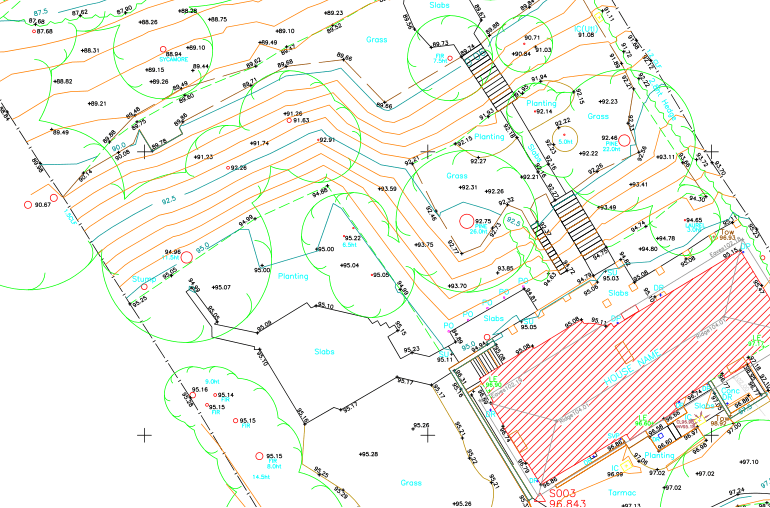
Topographic Surveys Overview
Topographic Surveys or Contour Surveys are used to establish elevations on the parcel. They may be required as part of real estate transactions, civil engineering design, and construction projects. They show elevations and grading features for architects, engineers, and building contractors. Elevation could greatly impact the planning phase since you may have to adjust your plans to level out elevation or work around it. A parcel’s elevation could determine whether it is suitable for your intended purpose in the first place. Consider a topographic survey as a proactive step to ensure that your property will be ideal for your plans.