
Registered Professional
Land Surveying
Licensed professional Land Surveyor in Central Georgia and South Metro Atlanta.
Contact usExperienced Professional
Integrity & Honesty
Technical Expertise
Registered Professional Land Surveying services
Land Surveyor Services for
Pike County, GA
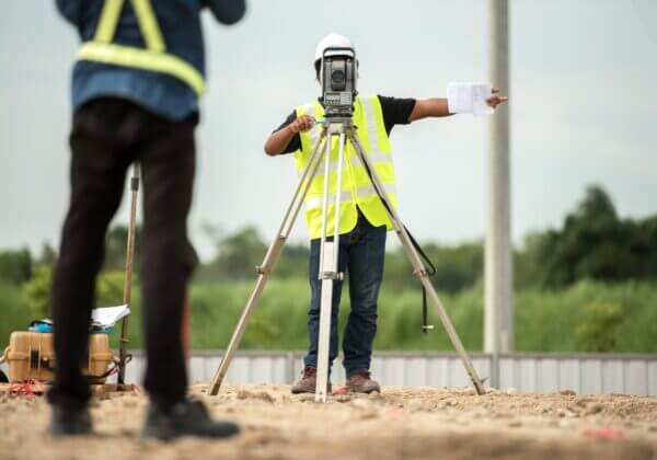
As an experienced Land Surveyor company, our team at Terra Services offers a comprehensive array of Registered Professional Land Surveying services for Pike County, GA and the surrounding region.
Land Surveyor Capabilities
The industries we serve include commercial and residential construction, commercial retailers, environmental engineering companies, state and federal agencies, institutions, pipeline/utility companies, and other projects that require a Professional Land Surveyor registered in Georgia.
The land surveying services we offer include:
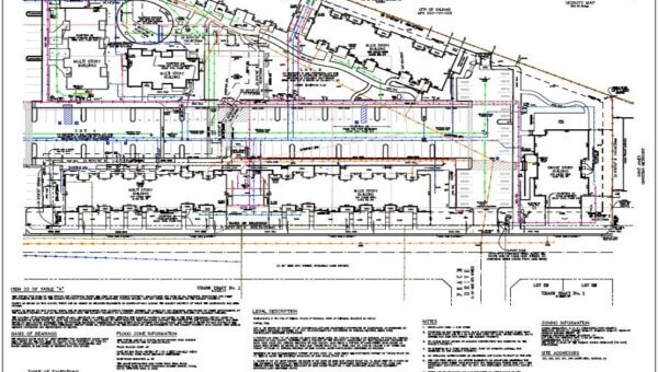
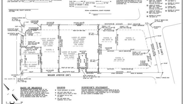
ALTA/NSPS Land Title Surveys
These surveys include detailed property information, including boundaries, property lines, encroachments, land ownership information, easements, real property, and liens.
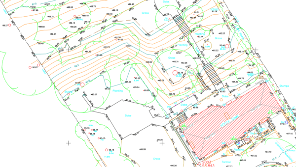
Topographic Surveys
Also called contour surveys, topographic surveys set elevations and identify grading features on a land parcel. They are often needed in construction projects, civil engineering designs, and real estate transactions.
Boundary Surveys
A land surveyor performs a boundary survey to pinpoint property lines and identify actual property corners of a parcel of land explained in a deed. They also include the degree of any encroachments or easements, and in some cases any limitations local or state regulations have placed upon the property.
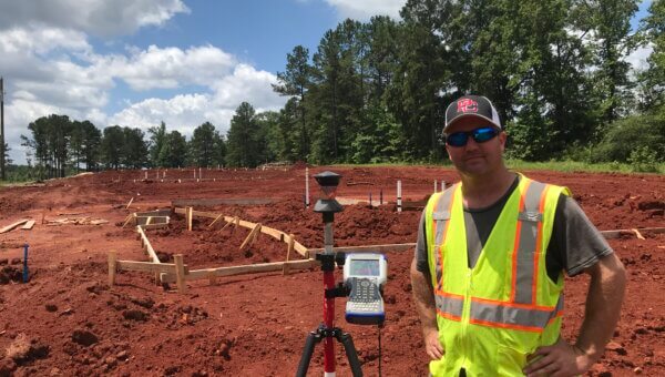
Construction Staking
These layouts or layout surveys show the analysis and interpretation of civil engineering and architectural plans with calculations made of proper offset survey points and elevations. Part of the staking process involves marking with stakes the elevation and location of certain improvements as given on approved architectural or engineering design drawings.
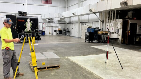
As-Built Surveys
A land surveyor company, such as ours, uses these surveys to identify construction improvements. State or local zoning boards may require one or more of these surveys throughout the timeframe of a construction project.
Property Line Staking
This type of staking service is often used for building improvements, such as fences or outbuildings. It is a valuable service for landowners to protect a property’s value.
FEMA-Flood Elevation Certificates
This certificate is a document created to accurately classify properties that are present inside FEMA flood map zones. It is also used to come up with policy rates for flood insurance.
Get an Experienced Land Surveyor Near Me
For more information about the land surveying services we offer at Terra Service for Pike County, GA and the surrounding areas, give us a call today at 770.468.9838 or send us a message through our contact form.
Our Services
Land Surveying services
in Middle Georgia and South Atlanta
Construction Staking
Construction Staking. also known as Construction Layout or Site Layout Survey, is the process... Read More
As-Builts
An As-Built Survey is used to locate construction improvements. Local or state zoning boards ... Read More
ALTA/NSPS Land Title Surveys
If you desire to understand the benefits of a Land Title Survey, you must research the tenure... Read More
Boundary Surveys
Boundary Surveys locate and note the parameters of a parcel. Boundary surveys find existing p... Read More
Topographic Surveys
Topographic Surveys or Contour Surveys are used to establish elevations on the parcel. They m... Read More
FEMA-Flood Elevation Certificates
A flood elevation certificate is a document required for properly classifying properties that... Read More
Property Line Staking
Property Line Staking is often required to build a fence, outbuilding, or other improvements.... Read More
About Terra Services
Terra Services Co., LLC is headed by Randy Davis.
- Georgia Registered Professional Land Surveyor #3448
- Graduate of Middle Georgia College
- SAMSOG (Surveying and Mapping Society of Georgia) member
- 20 years experience including 6 years in the utility right-of-way industry
- A wide range of experience ranging from rural boundary surveys, road construction, column line layout for mid-rise structures in Atlanta.
Contact us now for your next project!
Randy Davis
Owner/PLS 3448

Want to Know More?
770-468-9838

Recent Posts
Latest News & Blog


Contact us
Have an inquiry?
He, she, they are always lying and are not here right now, are they? Unless he, she, they are Land Surveyors, they have no business telling anyone where the boundary lines are. Real Estate Agents and sellers of real property are only trying to make a sale. Only a Professional Land Surveyor licensed in the State of Georgia can tell you where a property line is. Given the opportunity, any person will lie to protect or improve his interest.
Possibly. Old, ancient (established) fence can be a good indicator of boundary lines but should not be assumed to the be line. Neither you or I were there when the fence was installed so the only way to tell where the actual line is, is to survey and measure the line and compare the measurement between corner monuments to the existing records (deeds and plats). I have seen old barbed wire fence as much as 50 feet off of the line.
I/we are performing a professional service on your most valuable possession – your house and land. And unlike other investments to your property such as new vinyl siding, new floors, a deck built on the back of your house, a survey delineating boundary lines is a one and done cost if you preserve the survey markings and monuments.
Most people only see the survey crew come out and put stakes in the ground and are unaware of the preparation of the field work. The first part and most important part of a survey is the records research. Research is done not only on your property but also the surrounding properties to look for overlaps or gaps in ownership. The records (deeds and plats) are carefully evaluated and compiled and then field measurements and compared to the records. My goal is not to be cheap. My goal is to give you the best Survey possible at a competitive price.
In addition to the field work, we have equipment to pay for, insurance on equipment, insurance of vehicles, and cost of materials to pay for.
The expensive equipment you see is only taking the measurements. The ability to think and rationalize through a problem and discrepancy is what sets Professional Land Surveyors apart.