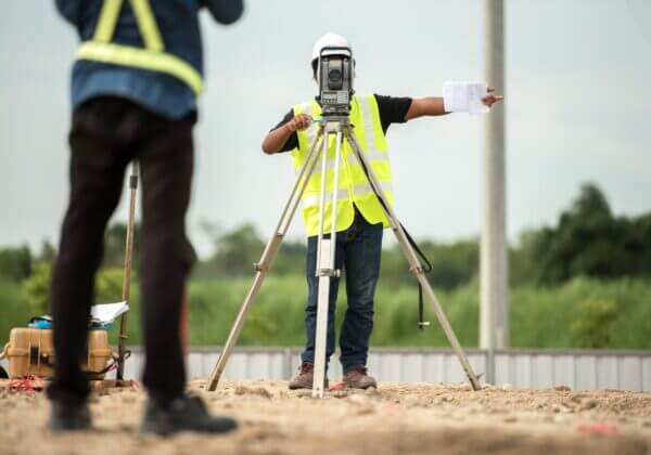
Land surveying provides valuable measurements and information, which can be crucial for securing financing, settling boundary disputes, planning future improvements, and more. A survey will make note of boundary lines, topography, structures on the property, utilities, and more. Whether you are considering a land survey to secure your mortgage, add a perimeter fence, plan a construction project, or anything in between, our team at Terra Services is prepared for the task. If you are unfamiliar with land surveying, we want to help you understand the basics.
Little Bit About Land Surveying
Regardless of whether you choose to have a land survey completed for your own information or at the request of a lender, you will gain beneficial information. A professional land survey company will provide the following vital information after your survey is complete:
- Your Boundary Lines—Being aware of the exact specifications of your land is valuable. If you are considering an improvement to your property, a survey will ensure that your improvement does not encroach on your neighbor’s land, which could cause strife and hassle.
- Locations of Additions, Structures, and Improvements—This information could be helpful if you purchased a property, and you are planning its future use and improvement. Also, lenders and government agencies will want these details sometimes for the sake of loans and permits.
- Geographic Features and Slopes—If you are working with an architect, contractor, or engineer planning your property’s structures and uses, they will want these details to account for them in your plans. Your property’s geographic layout may limit what you can do with your property or dictate the arrangement of your plans.
- Utilities and Easement Locations—Being aware of the location of your utilities will be especially crucial if you are considering an improvement. The last thing you would want to do is plan a building in a location where it cannot easily access the utility lines or damage a utility line during construction. If the land has easements that allow for your newly purchased land to be used by individuals or the city, you should be aware of it as it may limit what you can develop on your land.
- Possible Flood Risk—During a survey, your land will be evaluated to see if it falls in a floodplain. If it does, you may have to take certain flood prevention methods as well as secure flood insurance. You may need to shift the direction or location of your plans for the property based upon the flood risk.
We use a variety of tools and techniques to achieve the most accurate results for our clients. Some of our tools include robotic total station, advanced GPS systems, and 3D scanners. The combination of these tools allows us to measure slopes and angles, determine precise boundary lines, and discern changes in leveling and elevation. In addition to our tools, we also utilize our decades of experience and expertise to guide our process. Using the latest software developments in our field, we combine our notes and the readings from our devices to create a detailed land survey which you can understand fully.
If you need a professional land survey, schedule a visit from Terra Services. We will give you the vital information you need to fully understand your property and plan for the future.


